Maps
Historical maps, atlases, early modern national surveys, world maps and a whole lot more: bavarikon boasts an elaborate treasure trove of historical maps from all over the world. Besides the great works of Bavarian cartography, you will also find a wealth of historical city and town maps, maps of individual Bavarian regions, and maps on specialist topics, such as property and border dispute maps or military maps.
Embark on a voyage of discovery and explore not only the famous "Bayerische Landtafeln" by Philipp Apian or the "Topographische Atlas vom Königreiche Baiern" (Topographical Atlas of the Kingdom of Bavaria), but also such rare works as Mercator's globes and the "Carta Marina" by Olaus Magnus, of which only two surviving examples exist worldwide. All maps are high resolution and have a zoom-in function.
Filter
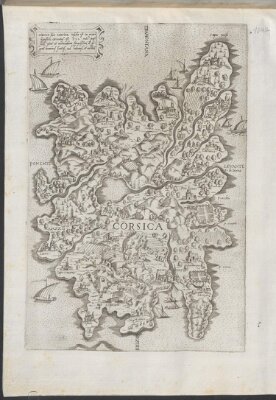
Cirnus sive Corsica insula est in mari ligustico ...
- Corsica
- Studienbibliothek Dillingen
- Identifier: BV043523490
- Call number: X 123#Nr.104a
- Identifier: urn:nbn:de:bvb:12-bsb00106714-2
- Licinio, Fabio
- Circa 1560
- [Italien]
- CC BY-NC-SA 4.0
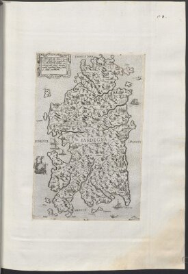
Sardinia insula inter Africum et Tyrrhenum ...
- Sardegna
- Studienbibliothek Dillingen
- Identifier: BV043523552
- Call number: X 123#Nr.104b
- Identifier: urn:nbn:de:bvb:12-bsb00106715-7
- Licinio, Fabio
- Circa 1560
- [Italien]
- CC BY-NC-SA 4.0
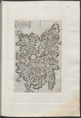
Cirnvs siue Corsica insula est in mari ligustico…
- Cirnus sive Corsica
- Studienbibliothek Dillingen
- Identifier: BV043704318
- Call number: X 122#Nr.57
- Identifier: urn:nbn:de:bvb:12-bsb00107354-7
- Licinio, Fabio
- [1555-1565]
- [Italien]
- CC BY-NC-SA 4.0
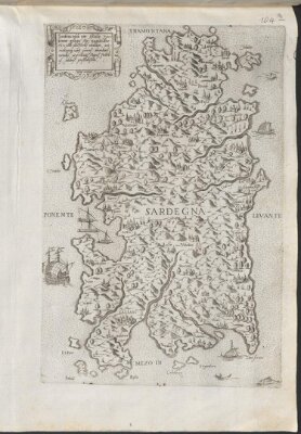
Sardinia insula inter Africu et Tyrrhenum pelagus sita …
- Studienbibliothek Dillingen
- Identifier: urn:nbn:de:bvb:12-bsb00107355-3
- Call number: X 122#Nr.58
- Identifier: BV043704323
- Licinio, Fabio
- [1555-1565]
- [Italien]
- CC BY-NC-SA 4.0