Karten
Historische Landkarten, Atlanten, frühneuzeitliche Landesaufnahmen, Weltkarten und vieles mehr: bavarikon verfügt über einen umfangreichen Schatz an historischen Karten aus aller Welt. Sie finden nicht nur die großen Werke bayerischer Kartografie, sondern auch zahlreiche historische Stadtpläne und Karten zu einzelnen Regionen in Bayern sowie zu speziellen Themen, etwa Karten zu Besitz- und Grenzstreitigkeiten oder Militärkarten.
Gehen Sie auf Entdeckungsreise und erkunden Sie neben den berühmten „Bayerischen Landtafeln“ Philipp Apians oder dem „Topographischen Atlas vom Königreiche Baiern“ seltene Werke wie die Globen von Mercator und die „Carta Marina“ des Olaus Magnus, von der weltweit nur zwei Exemplare vorhanden sind. Alle Karten sind hochauflösend und können herangezoomt werden.
Filter
Nürnberg 1730-1760
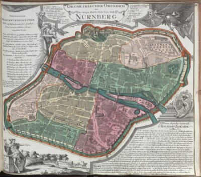
- Seutter, Matthäus: Geometrischer Grundris Der Des Heiligen Römischen Reichs Freÿen Stadt Nürnberg
- Bayerische Staatsbibliothek
- Signatur: 2 Mapp. 76 a-66
- Identifikator: BV000706685
- Johann Baptist Homann
- Matthäus Seutter
- Jeremias Wolf
- 1730 - 1760
- Augsburg
- CC BY-NC-SA 4.0
Nürnberg 1730
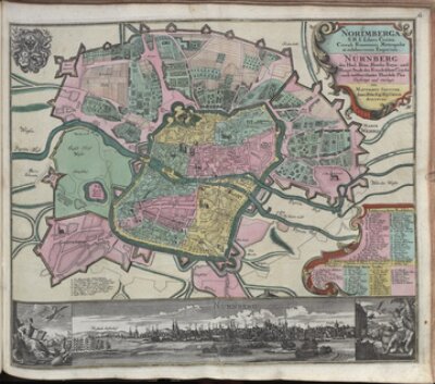
- Seutter, Matthäus: Norimberga S. R. I. Libera Civitas, Circuli Franconici Metropolis et celeberrimum Emporium
- Bayerische Staatsbibliothek
- Identifikator: BV000706687
- Signatur: 2 Mapp. 76 a-67
- Johann Baptist Homann
- Matthäus Seutter
- Jeremias Wolf
- 1730 - 1760
- Augsburg
- CC BY-NC-SA 4.0
Regensburg 1730-1760
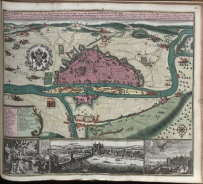
- Seutter, Matthäus / Kraus, Johann Ulrich: Ratisbona in media Bavaria ad Danubium sita
- Bayerische Staatsbibliothek
- Identifikator: BV000706697
- Signatur: 2 Mapp. 76 a-72
- Johann Baptist Homann
- Matthäus Seutter
- Jeremias Wolf
- 1730 - 1760
- Augsburg
- CC BY-NC-SA 4.0
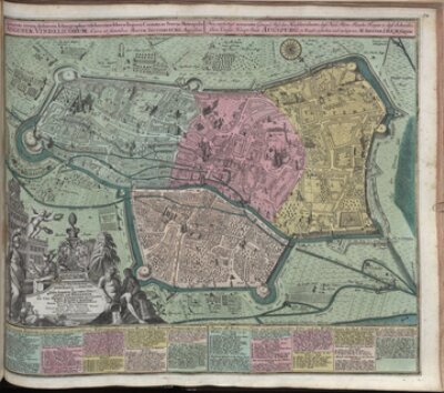
Seutter, Matthäus / Kraus, Johann Thomas: Accurata recens delineata Ichnographia celeberrimae liberae Imperii Civitatis ac Sveviae Metropolis Augusta…
- Bayerische Staatsbibliothek
- Identifikator: BV000706701
- Signatur: 2 Mapp. 76 a-74
- Johann Baptist Homann
- Matthäus Seutter
- Jeremias Wolf
- 1730 - 1760
- Augsburg
- CC BY-NC-SA 4.0
Diözese Freising
- Seutter, Matthäus: Accurata Delineatio Episcopatus Frisingensis una cum Dynastia Burkrainensi Et Comitatu Werdenfelsensi Episcopatui subjectis
- Bayerische Staatsbibliothek
- Signatur: 3 Mapp. 8,3-1,52
- Identifikator: BV000668057
- Johann Baptist Homann
- Matthäus Seutter
- Jeremias Wolf
- 1740 - 1756
- Augsburg
- CC BY-NC-SA 4.0
München 1740-1760
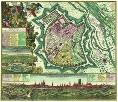
- Seutter, Matthäus: München, die weitberühmt, praechtig und wohl fortificirte Chur-Fürstl. Haupt- u. Residenz-Stadt des Herzogthums Bayern
- Bayerische Staatsbibliothek
- Identifikator: BV000644502
- Signatur: 2 Mapp. 8,4-1,50
- Johann Baptist Homann
- Matthäus Seutter
- Jeremias Wolf
- 1740 - 1760
- Augsburg
- CC BY-NC-SA 4.0
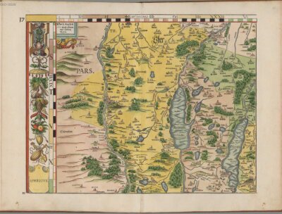
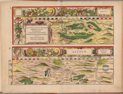
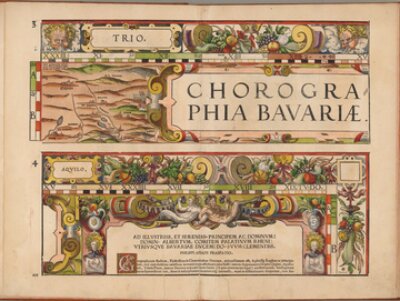
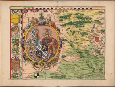
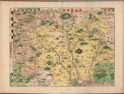
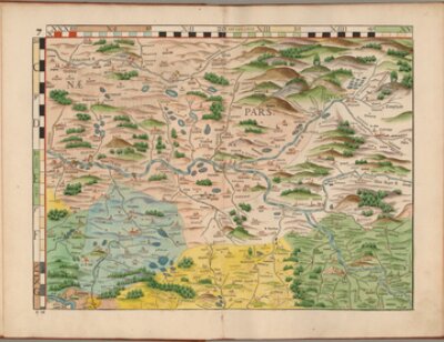
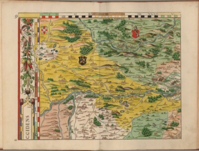
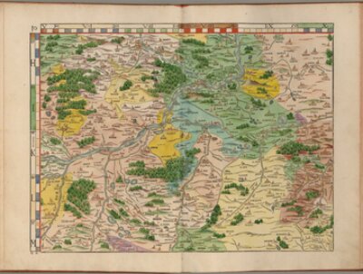
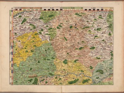
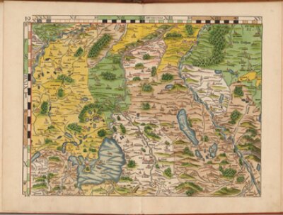
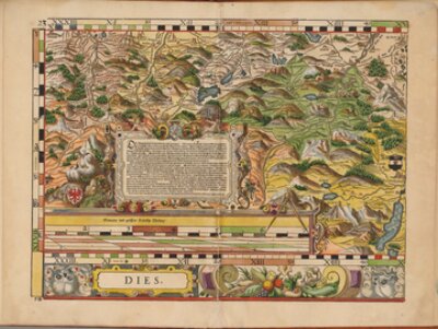
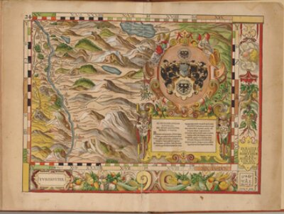
Apian, Philipp: Bairische Landtafeln 1568 - Gesamtkarte
- Philipp Apian: Bairische Landtaflen
- Philipp Apian: Bairische Landtafeln
- Bayerische Staatsbibliothek
- Signatur: Hbks/F 15 b
- Identifikator: BV039747789
- Albrecht V., Herzog von Bayern
- Philipp Apian
- 1568
- Ingolstadt
- CC BY-NC-SA 4.0
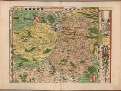
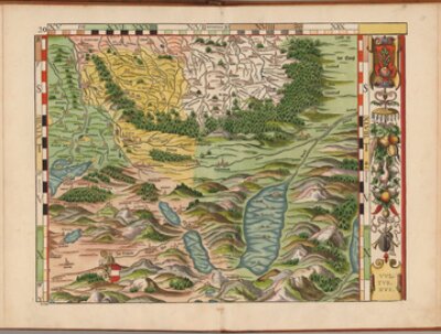
Apian, Philipp: Bairische Landtafeln 1568, Landtafel 1/2
- Landtafel 1/2
- Bayerische Staatsbibliothek
- Signatur: Hbks/F 15 b
- Identifikator: BV039747789
- Albrecht V., Herzog von Bayern
- Philipp Apian
- 1568
- Ingolstadt
- CC BY-NC-SA 4.0
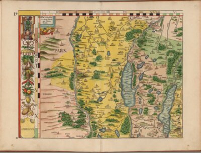
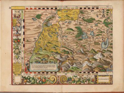
Apian, Philipp: Bairische Landtafeln 1568, Landtafel 3/4
- Landtafel 3/4
- Bayerische Staatsbibliothek
- Signatur: Hbks/F 15 b
- Identifikator: BV039747789
- Albrecht V., Herzog von Bayern
- Philipp Apian
- 1568
- Ingolstadt
- CC BY-NC-SA 4.0
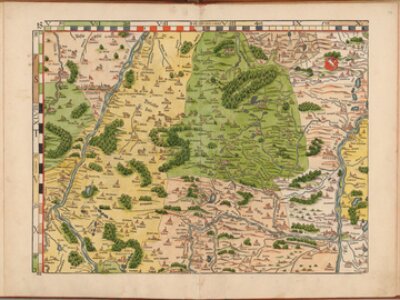
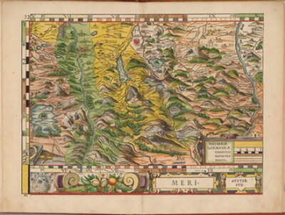
Apian, Philipp: Bairische Landtafeln 1568, Landtafel 5
- Landtafel 5
- Bayerische Staatsbibliothek
- Signatur: Hbks/F 15 b
- Identifikator: BV039747789
- Albrecht V., Herzog von Bayern
- Philipp Apian
- 1568
- Ingolstadt
- CC BY-NC-SA 4.0
Apian, Philipp: Bairische Landtafeln 1568, Landtafel 6
- Landtafel 6
- Bayerische Staatsbibliothek
- Signatur: Hbks/F 15 b
- Identifikator: BV039747789
- Albrecht V., Herzog von Bayern
- Philipp Apian
- 1568
- Ingolstadt
- CC BY-NC-SA 4.0
Apian, Philipp: Bairische Landtafeln 1568, Landtafel 7
- Landtafel 7
- Bayerische Staatsbibliothek
- Signatur: Hbks/F 15 b
- Identifikator: BV039747789
- Albrecht V., Herzog von Bayern
- Philipp Apian
- 1568
- Ingolstadt
- CC BY-NC-SA 4.0
Apian, Philipp: Bairische Landtafeln 1568, Landtafel 8
- Landtafel 8
- Bayerische Staatsbibliothek
- Signatur: Hbks/F 15 b
- Identifikator: BV039747789
- Albrecht V., Herzog von Bayern
- Philipp Apian
- 1568
- Ingolstadt
- CC BY-NC-SA 4.0
Apian, Philipp: Bairische Landtafeln 1568, Landtafel 9
- Landtafel 9
- Bayerische Staatsbibliothek
- Signatur: Hbks/F 15 b
- Identifikator: BV039747789
- Albrecht V., Herzog von Bayern
- Philipp Apian
- 1568
- Ingolstadt
- CC BY-NC-SA 4.0
Apian, Philipp: Bairische Landtafeln 1568, Landtafel 10
- Landtafel 10
- Bayerische Staatsbibliothek
- Signatur: Hbks/F 15 b
- Identifikator: BV039747789
- Albrecht V., Herzog von Bayern
- Philipp Apian
- 1568
- Ingolstadt
- CC BY-NC-SA 4.0
Apian, Philipp: Bairische Landtafeln 1568, Landtafel 11
- Landtafel 11
- Bayerische Staatsbibliothek
- Signatur: Hbks/F 15 b
- Identifikator: BV039747789
- Albrecht V., Herzog von Bayern
- Philipp Apian
- 1568
- Ingolstadt
- CC BY-NC-SA 4.0
Apian, Philipp: Bairische Landtafeln 1568, Landtafel 12
- Landtafel 12
- Bayerische Staatsbibliothek
- Signatur: Hbks/F 15 b
- Identifikator: BV039747789
- Albrecht V., Herzog von Bayern
- Philipp Apian
- 1568
- Ingolstadt
- CC BY-NC-SA 4.0
Apian, Philipp: Bairische Landtafeln 1568, Landtafel 13
- Landtafel 13
- Bayerische Staatsbibliothek
- Signatur: Hbks/F 15 b
- Identifikator: BV039747789
- Albrecht V., Herzog von Bayern
- Philipp Apian
- 1568
- Ingolstadt
- CC BY-NC-SA 4.0
Apian, Philipp: Bairische Landtafeln 1568, Landtafel 14
- Landtafel 14
- Bayerische Staatsbibliothek
- Signatur: Hbks/F 15 b
- Identifikator: BV039747789
- Albrecht V., Herzog von Bayern
- Philipp Apian
- 1568
- Ingolstadt
- CC BY-NC-SA 4.0
Apian, Philipp: Bairische Landtafeln 1568, Landtafel 15
- Landtafel 15
- Bayerische Staatsbibliothek
- Signatur: Hbks/F 15 b
- Identifikator: BV039747789
- Albrecht V., Herzog von Bayern
- Philipp Apian
- 1568
- Ingolstadt
- CC BY-NC-SA 4.0
Apian, Philipp: Bairische Landtafeln 1568, Landtafel 16
- Landtafel 16
- Bayerische Staatsbibliothek
- Signatur: Hbks/F 15 b
- Identifikator: BV039747789
- Albrecht V., Herzog von Bayern
- Philipp Apian
- 1568
- Ingolstadt
- CC BY-NC-SA 4.0
Apian, Philipp: Bairische Landtafeln 1568, Landtafel 17
- Landtafel 17
- Bayerische Staatsbibliothek
- Signatur: Hbks/F 15 b
- Identifikator: BV039747789
- Albrecht V., Herzog von Bayern
- Philipp Apian
- 1568
- Ingolstadt
- CC BY-NC-SA 4.0
Apian, Philipp: Bairische Landtafeln 1568, Landtafel 18
- Landtafel 18
- Bayerische Staatsbibliothek
- Signatur: Hbks/F 15 b
- Identifikator: BV039747789
- Albrecht V., Herzog von Bayern
- Philipp Apian
- 1568
- Ingolstadt
- CC BY-NC-SA 4.0
Apian, Philipp: Bairische Landtafeln 1568, Landtafel 19
- Landtafel 19
- Bayerische Staatsbibliothek
- Signatur: Hbks/F 15 b
- Identifikator: BV039747789
- Albrecht V., Herzog von Bayern
- Philipp Apian
- 1568
- Ingolstadt
- CC BY-NC-SA 4.0
Apian, Philipp: Bairische Landtafeln 1568, Landtafel 20
- Landtafel 20
- Bayerische Staatsbibliothek
- Signatur: Hbks/F 15 b
- Identifikator: BV039747789
- Albrecht V., Herzog von Bayern
- Philipp Apian
- 1568
- Ingolstadt
- CC BY-NC-SA 4.0
Apian, Philipp: Bairische Landtafeln 1568, Landtafel 21
- Landtafel 21
- Bayerische Staatsbibliothek
- Signatur: Hbks/F 15 b
- Identifikator: BV039747789
- Albrecht V., Herzog von Bayern
- Philipp Apian
- 1568
- Ingolstadt
- CC BY-NC-SA 4.0
Apian, Philipp: Bairische Landtafeln 1568, Landtafel 22
- Landtafel 22
- Bayerische Staatsbibliothek
- Signatur: Hbks/F 15 b
- Identifikator: BV039747789
- Albrecht V., Herzog von Bayern
- Philipp Apian
- 1568
- Ingolstadt
- CC BY-NC-SA 4.0
Apian, Philipp: Bairische Landtafeln 1568, Landtafel 23
- Landtafel 23
- Bayerische Staatsbibliothek
- Signatur: Hbks/F 15 b
- Identifikator: BV039747789
- Albrecht V., Herzog von Bayern
- Philipp Apian
- 1568
- Ingolstadt
- CC BY-NC-SA 4.0
Apian, Philipp: Bairische Landtafeln 1568, Landtafel 24
- Landtafel 24
- Bayerische Staatsbibliothek
- Signatur: Hbks/F 15 b
- Identifikator: BV039747789
- Albrecht V., Herzog von Bayern
- Philipp Apian
- 1568
- Ingolstadt
- CC BY-NC-SA 4.0
Apian, Philipp: Bairische Landtafeln, Auswahlübersicht 1651
- Überblickskarte
- Bayerische Staatsbibliothek
- Identifikator: BV039747789
- Signatur: Hbks/F 15 c
- Albrecht V., Herzog von Bayern
- Philipp Apian
- 1568
- Ingolstadt
- CC BY-NC-SA 4.0
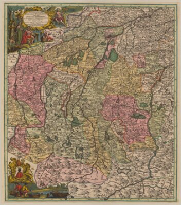
Visscher, Nicolaes: Bavariae Pars superior
- Bayerische Staatsbibliothek
- Identifikator: BV000441219
- Signatur: Mapp. XI,140 s
- 1680 - 1700
- Amsterdam
- CC BY-NC-SA 4.0
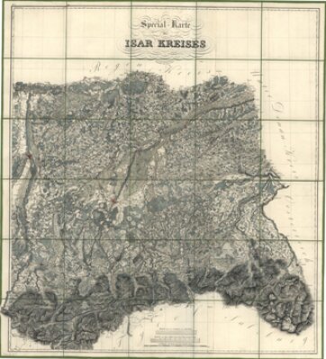
Coulon, Alois von: Special-Karte des Isar-Kreises
- Bayerische Staatsbibliothek
- Identifikator: BV000441227
- Signatur: Mapp. XI,140 u
- 1827
- [München]
- CC BY-NC-SA 4.0
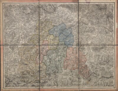
[Karte des Isarkreises nach dessen Einteilung in 6 Bezirksgerichte]
- Bayerische Staatsbibliothek
- Identifikator: BV000441222
- Signatur: Mapp. XI,141 f
- 1820 - 1840
- o.O.
- CC BY-NC-SA 4.0
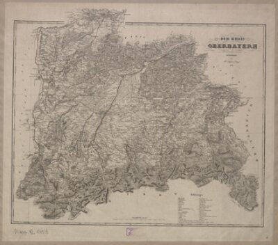
Campe, Friedrich: Der Kreis Oberbayern
- Bayerische Staatsbibliothek
- Signatur: Mapp. XI,142 d
- Identifikator: BV000441224
- 1839
- Nürnberg
- CC BY-NC-SA 4.0
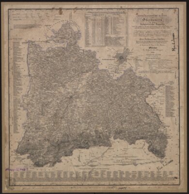
Khistler, Peter von / Mettenleiter, Peter / Päringer, Josef: Geographische Karte von Oberbayern in dem Königreiche Bayern
- Bayerische Staatsbibliothek
- Signatur: Mapp. XI,142 n
- Identifikator: BV000441226
- 1841
- München
- CC BY-NC-SA 4.0
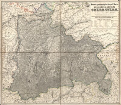
Topisch-geographische Spezial-Karte des Regierungs-Bezirk's Oberbayern
- Bayerische Staatsbibliothek
- Identifikator: BV014091705
- Signatur: Mapp. XI,145 a
- 1864
- Nürnberg
- CC BY-NC-SA 4.0
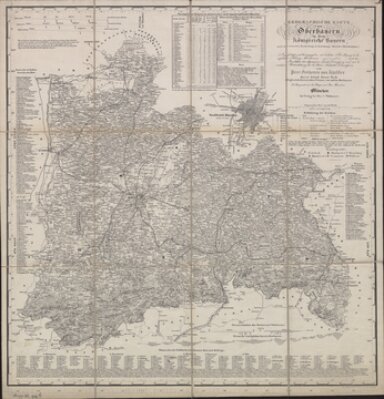
Geographische Karte von Oberbayern in dem Königreiche Bayern
- Bayerische Staatsbibliothek
- Identifikator: BV014091721
- Signatur: Mapp. XI,146 d
- 1872
- München
- CC BY-NC-SA 4.0
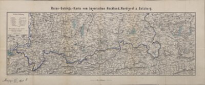
C. Schach's kleine Reise- und Gebirgskarte vom bayerischen Hochlande, Nordtyrol und Salzburg
- Bayerische Staatsbibliothek
- Identifikator: BV011469728
- Signatur: Mapp. XI,161 e
- 1868
- München
- CC BY-NC-SA 4.0
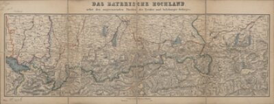
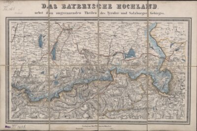
Das Bayerische Hochland nebst den angrenzenden Theilen des Tyroler und Salzburger Gebirges
- Bayerische Staatsbibliothek
- Identifikator: BV011474800
- Signatur: Mapp. XI,161 h
- 1869
- München
- CC BY-NC-SA 4.0
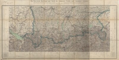
Das Bayerische Hochland nebst den angrenzenden Theilen des Tyroler und Salzburger Gebirges
- Bayerische Staatsbibliothek
- Identifikator: BV011474806
- Signatur: Mapp. XI,161 i
- 1869
- München
- CC BY-NC-SA 4.0
Heyberger, Joseph / Glas, Gustav: Neueste Reise-Karte für das Bayerische Hochland nebst einem Gebirgs-Profil
- Bayerische Staatsbibliothek
- Identifikator: BV011474827
- Signatur: Mapp. XI,161 k
- 1869
- München
- CC BY-NC-SA 4.0
Saint Michel, Henri de: München und Umgebung
- Bayerische Staatsbibliothek
- Identifikator: BV000441242
- Signatur: Mapp. XI,175-1
- Henri de Saint Michel
- Georg Friedrich Brander
- César-François Cassini de Thurys
- 1758 - 1778
- [vermutlich München]
- CC BY-NC-SA 4.0
Saint Michel, Henri de: Pfaffenhofen und Umgebung
- Bayerische Staatsbibliothek
- Identifikator: BV000441243
- Signatur: Mapp. XI,175-2
- Henri de Saint Michel
- Georg Friedrich Brander
- César-François Cassini de Thurys
- 1759 - 1779
- [vermutlich München]
- CC BY-NC-SA 4.0
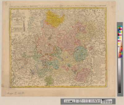
Güssefeld: Charte geographique du Cercle de Franconie
- Bayerische Staatsbibliothek
- Signatur: Mapp. XI, 284 p
- Identifikator: BV000451265
- Anton Friedrich Büsching
- Franz L. Güssefeld
- 1782
- Nürnberg
- CC BY-NC-SA 4.0
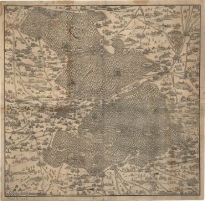
Weigel, Hans: Nürnberger Reichswälder
- Bayerische Staatsbibliothek
- Signatur: Mapp. XI,302 a
- Identifikator: BV000451690
- 1559
- [Nürnberg]
- CC BY-NC-SA 4.0
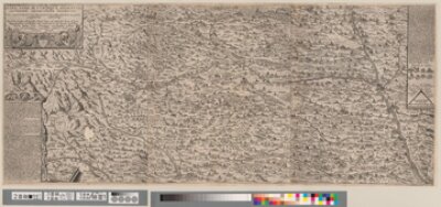
Hurter/Custos: Allgäu 1619
- Hurter/Custos: Des Ilerstroms Und Beyderseits Umbligenden Algöws Aussfuhrliche beschreibung
- Bayerische Staatsbibliothek
- Identifikator: BV000452850
- Signatur: Mapp. XI,374 l
- Raphael Custos
- Philipp Apian
- Christoph Hurter
- 1619
- Augsburg
- CC BY-NC-SA 4.0
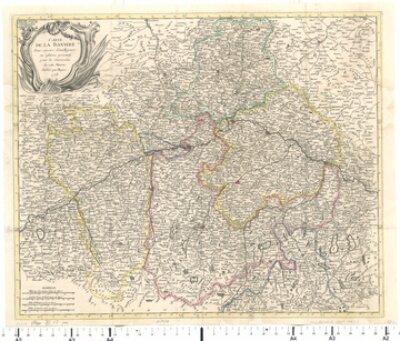
Mayer, Johann Tobias: Carte De La Baviere. Pour servire d'intelligence au affïres présente pour la Succession de cette Maison
- Bayerische Staatsbibliothek
- Signatur: Mapp. XI,37 pm
- Identifikator: BV012939589
- 1778
- S.l. [vermutl. Göttingen]
- CC BY-NC-SA 4.0
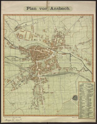
Ansbach 1900
- Plan von Ansbach
- Bayerische Staatsbibliothek
- Signatur: Mapp. XI,394 a
- Identifikator: BV011034342
- 1900
- Ansbach
- CC BY-NC-SA 4.0
Augsburg 1820
- [Stadtplan von Augsburg]
- Bayerische Staatsbibliothek
- Identifikator: BV000450655
- Signatur: Mapp. XI,401 o
- 1815 - 1830
- o.O.
- CC BY-NC-SA 4.0
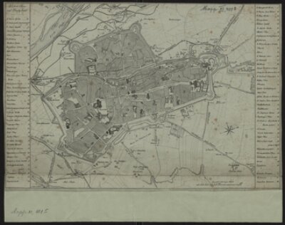
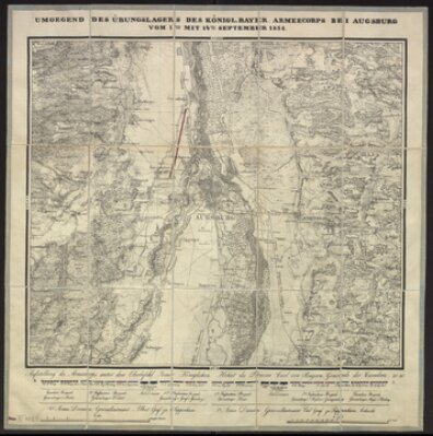
Umgegend Des Übungslagers ... Bei Augsburg , ca 1838
- Bayerische Staatsbibliothek
- Signatur: Mapp. XI,402 h
- Identifikator: BV000450659
- 1828 - 1848
- [München]
- CC BY-NC-SA 4.0